Sunday 13 November 2011

Hazleton

This was new walk devised from Hazleton village. The Puesdown Inn on the A40 is a decent pub restaurant as the pub in Cold Aston was closed for refurbishment.  It was a beautiful autumn day and mushrooms were everywhere.

Created by My Tracks on Android.
Total Distance: 13.86 km (8.6 mi)
Total Time: 2:59:12
Moving Time: 2:35:13
Average Speed: 4.64 km/h (2.9 mi/h)
Average Moving Speed: 5.36 km/h (3.3 mi/h)
Max Speed: 16.22 km/h (10.1 mi/h)
Min Elevation: 199 m (653 ft)
Max Elevation: 314 m (1029 ft)
Elevation Gain: 535 m (1756 ft)


View 2011-11-13 11:42 in a larger map

Monday 17 October 2011

Great Comberton

This walk from the village of Great Comberton around Bredon Hill.  No pubs on route but we did get a lot of blackberries and apples.


Created by My Tracks on Android.
Total Distance: 13.21 km (8.2 mi)
Total Time: 3:37:53
Moving Time: 3:27:42
Average Speed: 3.64 km/h (2.3 mi/h)
Average Moving Speed: 3.82 km/h (2.4 mi/h)
Max Speed: 19.74 km/h (12.3 mi/h)
Min Elevation: 87 m (284 ft)
Max Elevation: 340 m (1115 ft)
Elevation Gain: 348 m (1142 ft)
Max Grade: 11 %
Min Grade: -11 %
Recorded: Sun Oct 16 12:49:55 GMT 2011

View 2011-10-16 12:49 in a larger map

Sunday 2 October 2011

Craven Arms, Brockhampton

This walk from the Craven Arms in Brockhampton. On this rare occasion we were nine.  A beautiful day so we had Sunday lunch sitting in the garden.

Total Distance: 15.80 km (9.8 mi)
Total Time: 3:34:46
Moving Time: 2:35:17
Average Speed: 4.42 km/h (2.7 mi/h)
Average Moving Speed: 6.11 km/h (3.8 mi/h)
Max Speed: 25.96 km/h (16.1 mi/h)
Min Elevation: 205 m (671 ft)
Max Elevation: 347 m (1137 ft)
Elevation Gain: 608 m (1995 ft)
Max Grade: 0 %
Min Grade: 0 %
Recorded: Sun Sep 04 10:48:51 GMT+01:00 2011
View 2011-10-02 10:59 in a larger map

Sunday 4 September 2011

Hollow Bottom, Guiting Power

This is a weekend walk starting from, and definitely ending at the Hollow Bottom in Guiting Power.  A Sunday lunch carvery and a pint were most welcome after a fairly long walk, extended by the gathering of many sloes and blackberrys along the way.  I look forward to pie and gin.
Proper directions for this route are here.

Created by My Tracks on Android.
Total Distance: 15.80 km (9.8 mi)
Total Time: 3:34:46
Moving Time: 2:35:17
Average Speed: 4.42 km/h (2.7 mi/h)
Average Moving Speed: 6.11 km/h (3.8 mi/h)
Max Speed: 25.96 km/h (16.1 mi/h)
Min Elevation: 205 m (671 ft)
Max Elevation: 347 m (1137 ft)
Elevation Gain: 608 m (1995 ft)
Max Grade: 0 %
Min Grade: 0 %
Recorded: Sun Sep 04 10:48:51 GMT+01:00 2011


View 2011-09-04 10:48 in a larger map

Monday 22 August 2011

The Bear Inn, Bisley

Last official walk of the season and a return to and old favorite, the Bear Inn at Bisley.  Proper old fashioned pub that we can go in with the dogs, big log fire and friendly people.  Sadly, the hours of daylight are now against us but the sunset was our reward.

Created by My Tracks on Android.
Total Distance: 7.15 km (4.4 mi)
Total Time: 1:38:03
Moving Time: 1:23:20
Average Speed: 4.37 km/h (2.7 mi/h)
Average Moving Speed: 5.15 km/h (3.2 mi/h)
Max Speed: 10.06 km/h (6.3 mi/h)
Min Elevation: 227 m (744 ft)
Max Elevation: 297 m (975 ft)
Elevation Gain: 258 m (845 ft)
Max Grade: 0 %
Min Grade: 0 %
Recorded: Mon Aug 22 18:54:05 GMT+01:00 2011


View 2011-08-22 18:54 in a larger map

Monday 15 August 2011

Carpenters Arms, Miserden

Today's walk was from the Carpenters Arms at Miserden.  Nice walk and had dinner inside at the pub as getting dark.  Decent place.
Created by My Tracks on Android.
Total Distance: 6.64 km (4.1 mi)
Total Time: 1:30:37
Moving Time: 1:14:49
Average Speed: 4.40 km/h (2.7 mi/h)
Average Moving Speed: 5.32 km/h (3.3 mi/h)
Max Speed: 12.98 km/h (8.1 mi/h)
Min Elevation: 246 m (806 ft)
Max Elevation: 313 m (1026 ft)
Elevation Gain: 239 m (786 ft)
Max Grade: 0 %
Min Grade: 0 %
Recorded: Mon Aug 15 18:49:12 GMT 2011


View 2011-08-15 18:49 in a larger map

Monday 8 August 2011

Butchers Arms, Sheepscombe

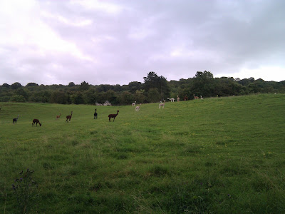
Today's walk was from the Butchers Arms at Sheepscombe. Something of a classic for us and a chance to see native Gloucestershire Llamas, see earlier variation.  As we returned to the pub there was a group of female morris dancers performing in the street.

Created by My Tracks on Android.
Total Distance: 7.63 km (4.7 mi)
Total Time: 1:53:32
Moving Time: 1:29:26
Average Speed: 4.03 km/h (2.5 mi/h)
Average Moving Speed: 5.12 km/h (3.2 mi/h)
Max Speed: 12.07 km/h (7.5 mi/h)
Min Elevation: 148 m (487 ft)
Max Elevation: 253 m (830 ft)
Elevation Gain: 345 m (1132 ft)
Max Grade: 0 %
Min Grade: 0 %
Recorded: Mon Aug 08 18:50:23 GMT+01:00 2011

View Butchers Arms, Sheepcombe in a larger map

Monday 1 August 2011

Air Balloon, Birdlip

This walk was was from the Air Balloon pub on Birdlip Hill.  Since Crickley Hill Country park has started to charge for parking, the pub is now pay and display in the daytime.
Created by My Tracks on Android.
Total Distance: 6.27 km (3.9 mi)
Total Time: 1:28:57
Moving Time: 1:16:41
Average Speed: 4.23 km/h (2.6 mi/h)
Average Moving Speed: 4.91 km/h (3.0 mi/h)
Max Speed: 12.50 km/h (7.8 mi/h)
Min Elevation: 262 m (861 ft)
Max Elevation: 337 m (1104 ft)
Elevation Gain: 249 m (817 ft)
Max Grade: 0 %
Min Grade: 0 %
Recorded: Mon Aug 01 18:45:59 GMT+01:00 2011

View Air Balloon in a larger map

Monday 25 July 2011

The Royal George, Birdlip

This is our second attempt at the walk, having been thwarted by the Great Western railway last week.  Starting and finishing at The Royal George Hotel in Birdlip, we had a very pleasant walk, apart from a large heard of curious bulls that came to see us in the last field.  The route takes in the Roman villa and Witcombe reservoir.

Created by My Tracks on Android.
Total Distance: 8.98 km (5.6 mi)
Total Time: 1:58:33
Moving Time: 1:27:31
Average Speed: 4.55 km/h (2.8 mi/h)
Average Moving Speed: 6.16 km/h (3.8 mi/h)
Max Speed: 13.74 km/h (8.5 mi/h)
Min Elevation: 137 m (449 ft)
Max Elevation: 355 m (1164 ft)
Elevation Gain: 452 m (1484 ft)
Max Grade: -2 %
Min Grade: -10 %
Recorded: Mon Jul 25 18:38:54 GMT+01:00 2011


View The Royal George, Birdlip in a larger map

Saturday 9 July 2011

Reservoir & Lineover Wood

This walk starts at the (now closed) Reservoir Inn on the the A40 and goes around Lineover Wood and Dowdeswell Reservoir.  The pub is now closed but the car park is open.  We took the route of the Cheltenham Circular Challenge up the hill and down through the estate.  I'd recommend seeing the broad leafed limes.  We found wild raspberry and ripe cherries on our route.

Created by My Tracks on Android.
Total Distance: 8.20 km (5.1 mi)
Total Time: 2:05:26
Moving Time: 1:30:13
Average Speed: 3.92 km/h (2.4 mi/h)
Average Moving Speed: 5.45 km/h (3.4 mi/h)
Max Speed: 15.72 km/h (9.8 mi/h)
Min Elevation: 150 m (493 ft)
Max Elevation: 346 m (1134 ft)
Elevation Gain: 412 m (1353 ft)
Max Grade: 0 %
Min Grade: 0 %
Recorded: Sat Jul 09 13:20:48 GMT+01:00 2011
Activity type: -

View Reservior Inn in a larger map

Monday 4 July 2011

The Edgemoor Inn, Edge

Today's walk was from the Edgemoor Inn, up to the map on Haresfield Beacon. The way back was something new as we found a redirected path that wasn't there last year. All a bit of a rush as the pub now stops doing food at 8.30 but that's fine. We sat out with the dogs which is no hardship as it was sunny and the view is the main reason to go there.

Total Distance: 7.16 km (4.5 mi)
Total Time: 1:36:30
Moving Time: 1:18:03
Average Speed: 4.45 km/h (2.8 mi/h)
Average Moving Speed: 5.51 km/h (3.4 mi/h)
Max Speed: 10.06 km/h (6.3 mi/h)
Min Elevation: 219 m (719 ft)
Max Elevation: 317 m (1041 ft)
Elevation Gain: 272 m (891 ft)
Max Grade: 0 %
Min Grade: 0 %
Recorded: Mon Jul 04 18:50:43 GMT+01:00 2011

View Edgemoor Inn in a larger map

Monday 27 June 2011

Falcon Inn, Painswick

After a scorching Sunday, today's walk from the Falcon Inn at Painswick was a wet one.  Dogs are allowed in the bar, and they enjoyed clearing up a spilled pint of Butcombe.

Created by My Tracks on Android.
Total Distance: 5.44 km (3.4 mi)
Total Time: 1:37:45
Moving Time: 1:12:00
Average Speed: 3.34 km/h (2.1 mi/h)
Average Moving Speed: 4.53 km/h (2.8 mi/h)
Max Speed: 9.00 km/h (5.6 mi/h)
Min Elevation: 142 m (467 ft)
Max Elevation: 223 m (732 ft)
Elevation Gain: 233 m (766 ft)
Max Grade: 0 %
Min Grade: 0 %
Recorded: Mon Jun 27 18:57:44 GMT+01:00 2011


View Falcon Inn, Painswick in a larger map